
Detailed cartography for sea and lakes makes Navionics+ the best choice for cruising, fishing and sailing. Find the most accurate navigation data for your chartplotter, an exclusive map down to 0.5m depth improved by mariners like you, with unique local content shared by Navionics app users. Navionics creates thousands of updates every day, so you always have the latest data. Daily updates and advanced features are included in the price for a period of one year.
Navionics
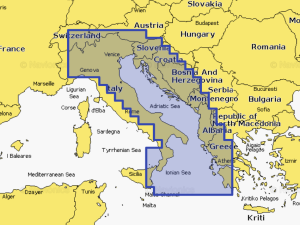
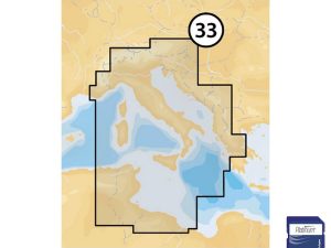
Part number: 010-C1318-30/ITP Chart Code: NAEU014R Coastal coverage of the Po River and the Adriatic coast of Italy, Slovenia, Croatia, Albania, the western coast of Greece and southern Italy. Coverage includes eastern Sicily, the Straits of Messina, the Dalmatian Coast, the Gulf of Taranto, Lago Maggiore, Lago d'Iseo, Lago di Como and Lago di Garda.
Navionics
010-C1318-40/ITP n nChart Code: NPEU014R n nCoastal coverage of the Po River and the Adriatic coast of Italy, Slovenia, Croatia, Albania, the western coast of Greece and southern Italy. Coverage includes eastern Sicily, the Straits of Messina, the Dalmatian Coast, the Gulf of Taranto, Lago Maggiore, Lago d'Iseo, Lago di Como and Lago di Garda.
Lowrance
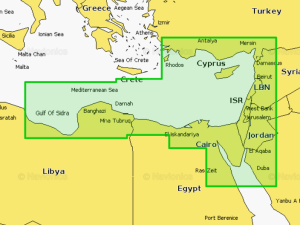
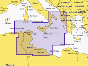
Navionics Platinum+ 5P269XL Mediterranean South East
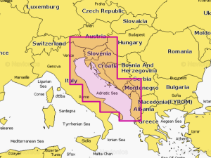
Navionics Platinum+ 5P272XL Central Mediterranean
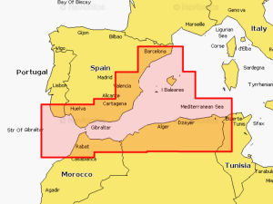
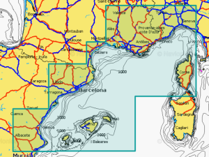
MSD/5P275XL Navionics Platinum+XL Mediterranean South West
NAVIONICS EU Mediterranean Central Platinum Marine Charts
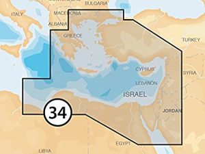
NAVIONICS EU Mediterranean East Platinum Marine Charts